Earth Mesh System
Unstructured Mesh Generation for Earth Surface Modeling
Earth Mesh System Research
The Earth mesh system is a core technology in land surface modeling. By constructing flexible unstructured meshes, it accurately represents the spatial heterogeneity of the Earth’s surface. We are committed to developing advanced mesh generation technologies to provide high-precision spatial discretization schemes for land surface models, thereby enhancing the simulation capability of complex terrain and diverse surface features.
Revolutionizing Land Surface Modeling Technology
Land Surface Models (LSMs) play a critical role in simulating the complex interactions between land and atmosphere, profoundly influencing our understanding of climate, weather patterns, and hydrological processes. However, traditional land surface models typically rely on structured grids, making it difficult to accurately represent Earth’s complex and variable terrain features. Our latest research introduces a powerful tool to address this challenge.

Unstructured Mesh Generation: A Paradigm Shift
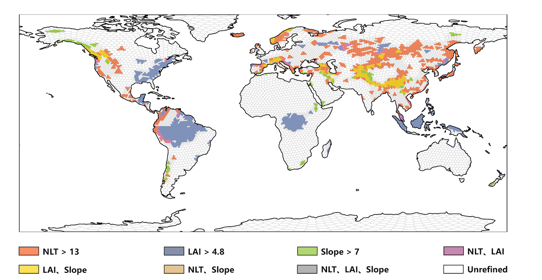
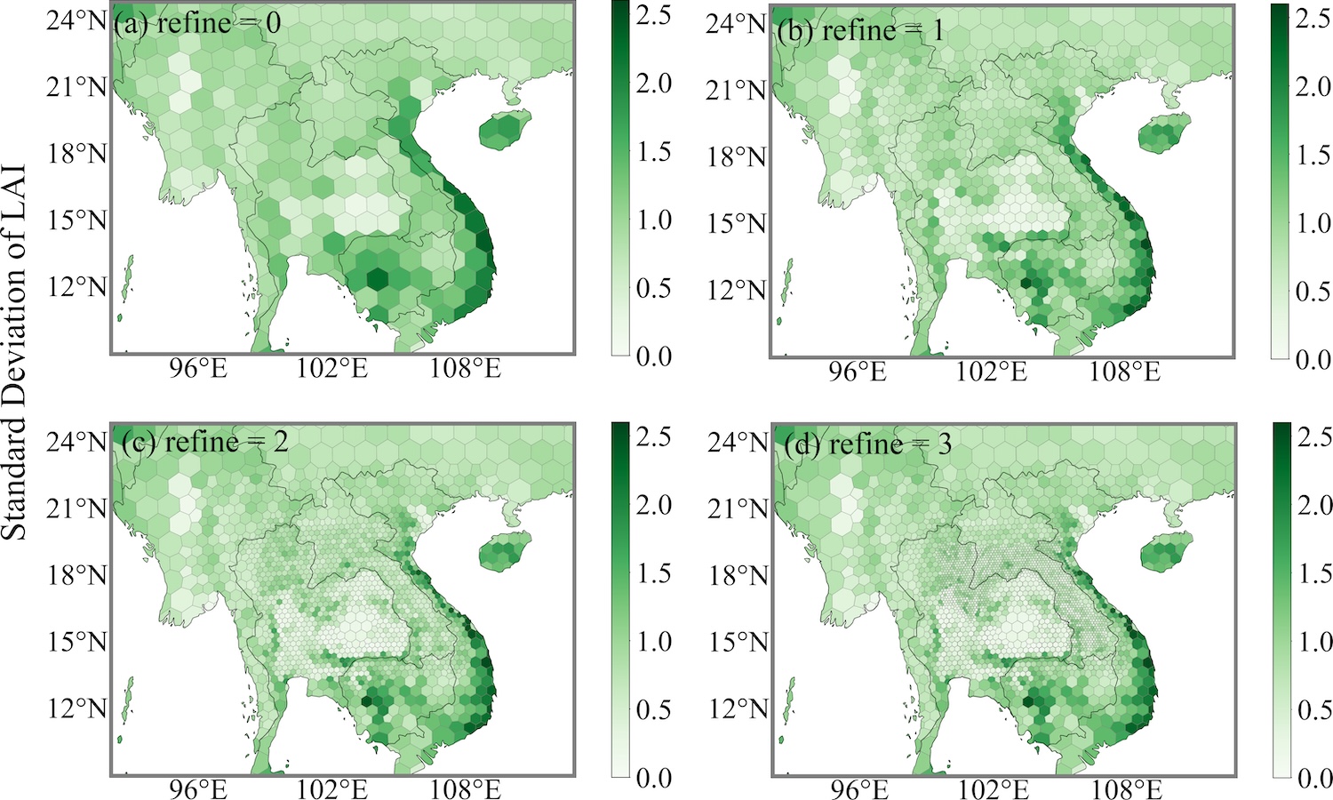
We have developed an innovative tool for generating unstructured meshes, providing a more flexible and accurate representation of spatial heterogeneity for land surface models. This tool intelligently refines mesh resolution based on various landscape criteria (such as elevation, slope, land cover, and land use). This ensures that areas with greater variability can be modeled with finer detail, resulting in more realistic simulations of hydrological processes.

Improved Hydrological Simulations
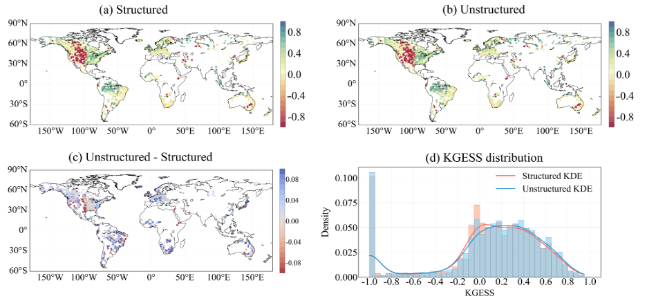
By coupling our refined unstructured meshes with the Common Land Model (CoLM), we have achieved significant improvements in simulating key hydrological variables. Runoff, river discharge, and flood inundation can now be modeled with higher accuracy, particularly in areas with complex terrain. This has profound implications for disaster prevention, water resource management, and climate change research.

The Future of Land Surface Modeling
Our unstructured mesh generation tool represents a significant advancement in the field of land surface modeling. It enables researchers and practitioners to simulate Earth’s complex processes with unprecedented accuracy and efficiency. As we continue to refine and expand its capabilities, we anticipate that land surface models will provide more precise insights into Earth’s dynamic systems.
EarthMesh: Next-Generation Mesh Generation Tool
We are developing EarthMesh, a mesh generation tool designed for land surface, ocean, and atmospheric models. This tool supports various Earth system models, including but not limited to:
- Common Land Model 2024 (CoLM2024): Next-generation land surface model
- FVCOM: Finite Volume Community Ocean Model
- MPAS: Model for Prediction Across Scales
- OLAM: Ocean-Land-Atmosphere Model
EarthMesh features the following core capabilities:
- Adaptive mesh refinement: Intelligent mesh refinement based on various surface features
- User-specified refinement: Precise mesh control according to user intent
- Multi-type mesh generation: Unified generation of land surface, ocean, and atmospheric meshes
- Flexible configuration options: Customized generation of different mesh types through mesh_type variables
The development of this tool marks our significant leap from single land surface mesh generation to whole Earth system mesh generation, providing a more unified and efficient mesh solution for Earth system modeling.
Core Research Directions
Multi-Model Mesh Generation Technology
- Unified generation algorithms for land surface, ocean, and atmospheric meshes
- Boundary processing techniques for meshes of different media
- Quality assessment system for multi-model meshes
- Configuration and management system for mesh types
Adaptive Mesh Refinement Technology
- Feature-based adaptive mesh refinement
- Multi-scale mesh resolution optimization algorithms
- Mesh quality assessment and quality control
- Large-scale parallel mesh generation technology
Mesh and Model Coupling Technology
- Interface development between unstructured meshes and different models
- Mapping algorithms between mesh data and model variables
- Impact assessment of mesh resolution on model accuracy
- Mesh optimization for multi-physics process coupling
High-Performance Computing Applications
- Parallel generation algorithms for large-scale meshes
- Distributed storage and access of mesh data
- Efficient parallel strategies for mesh computation
- Scalability optimization of mesh systems
Application Areas
- Land Surface Modeling: Providing high-precision meshes for land surface models like CoLM2024
- Ocean Simulation: Providing ocean meshes for ocean models like FVCOM
- Atmospheric Modeling: Providing atmospheric meshes for atmospheric models like MPAS and OLAM
- Earth System Modeling: Supporting unified mesh systems for land-ocean-atmosphere coupling
- Climate Research: Improving regional and global climate simulation capabilities
Open Research Topics
Earth mesh system research offers rich research opportunities for graduate students and collaborators. The following are our current research focuses:
We welcome graduate students and collaborators interested in any of the above topics to contact us and jointly advance the innovative development of Earth mesh system research!
Related Publications (# indicates corresponding author):
-
Fan, H., Xu, Q., Bai, F., Wei, Z.#, Zhang, Y., Lu, X., Wei, N., Zhang, S., Yuan, H., Liu, S., Li, X., Li, X., Dai, Y. (2024). An unstructured mesh generation tool for efficient high-resolution representation of spatial heterogeneity in land surface models. Geophysical Research Letters, 51(6), e2023GL107059.
-
More related research results will be published successively…